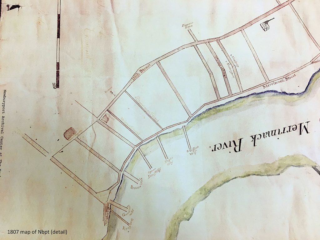
A detail of a 1807 map that shows the wide part of High Street, Courtesy of the Newburyport Archival Center
A detail of a 1807 map that shows the wide part of High Street, Courtesy of the Newburyport Archival Center
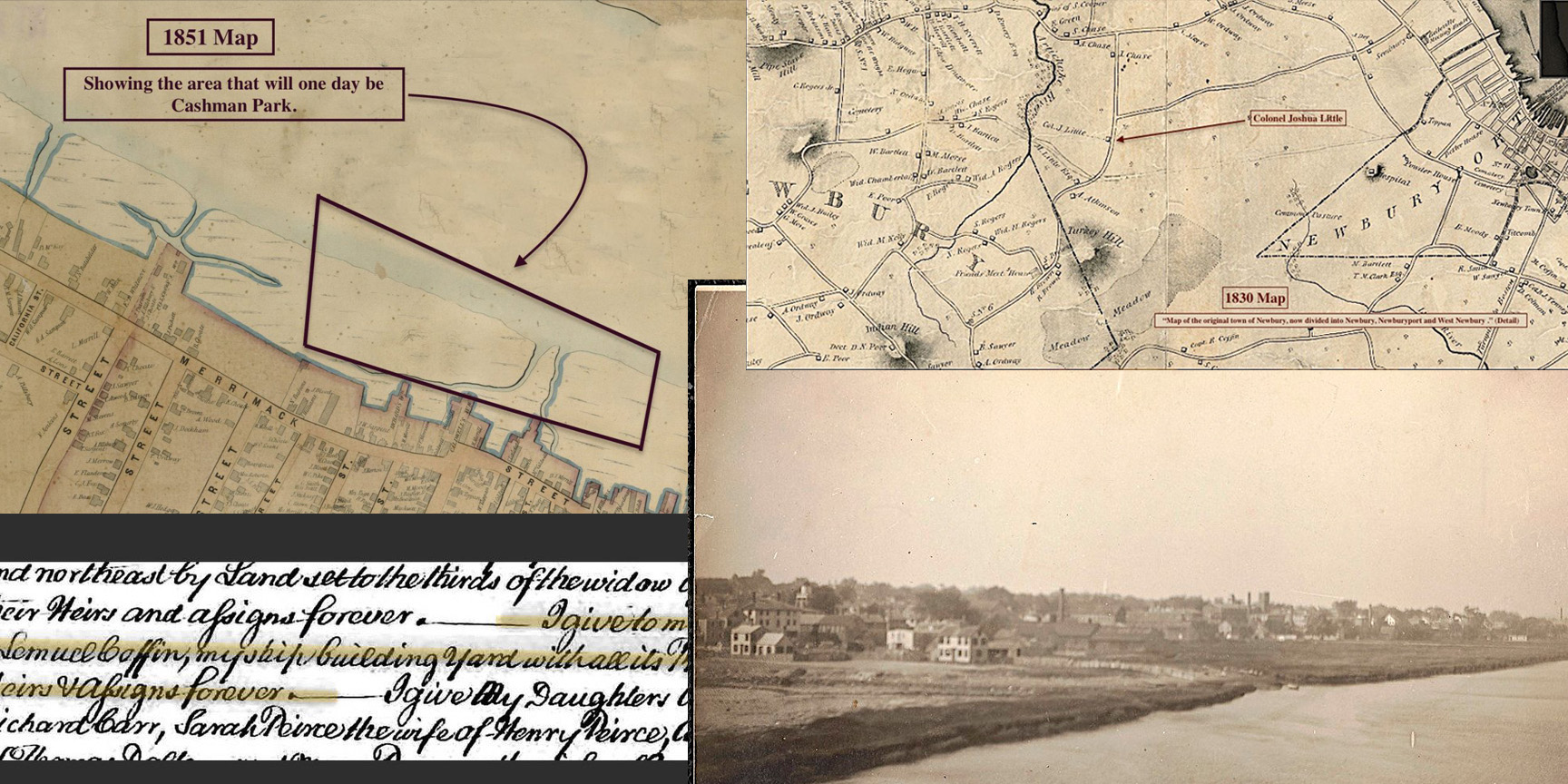
After the fight to save High Street that began in 1998, the High Street Master Plan came into being and the first (and only phase) of the High Street Master Plan was implemented – the bike lanes. There was such a “hubbub” about the bike lanes (they’d been talked about for 6 years) that they were never actually finished, the High Street Master Plan was vetoed in mid-execution. However, it was finally passed unanimously by the Newburyport City Council, but funding had long since dried up for any further pursuit of the High Street Master Plan.
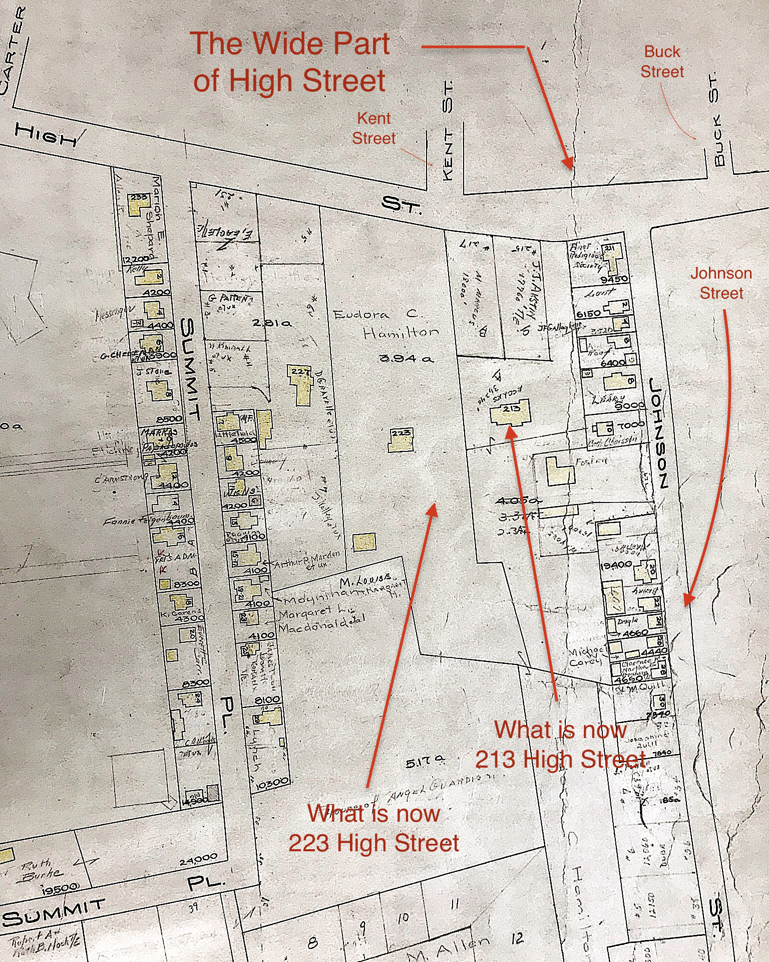
One of the areas that had long been of concern was the very wide part of the road between Buck, Johnson and Kent Streets. Two years ago the city got a grant to narrow that part of the road and emphasizing biking, walking and being able to safely cross that area of the street, which is really dangerous.*^* Geordie Vining of the Newburyport Planning Office asked Sharon Spieldenner of the Newburyport Archival Center if there was any reason why that particular part of High Street was so wide. It sounded like a really fun research project and I was “all in.”
This is what we’ve discovered so far.
“Tradition says that it (High Street) was an Indian trail in the beginning, as the low land along the river banks was marshy and sandy, hard to travel upon.” *
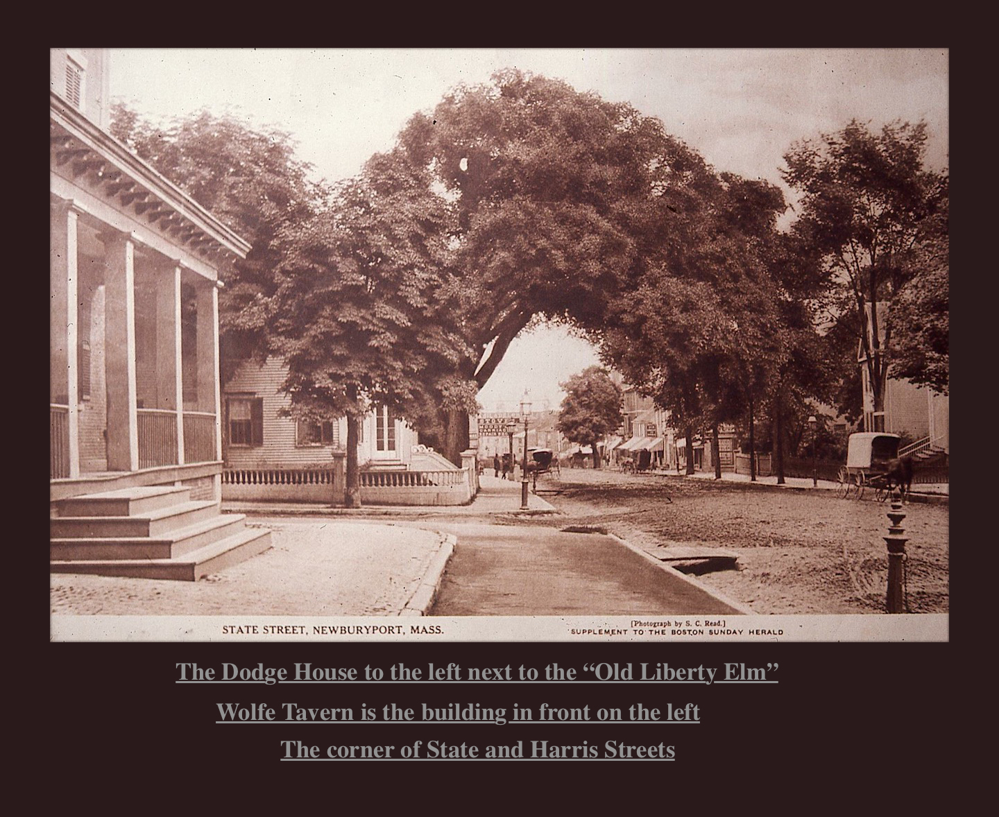
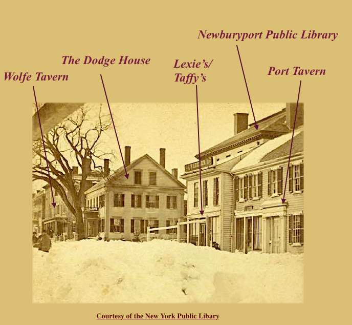
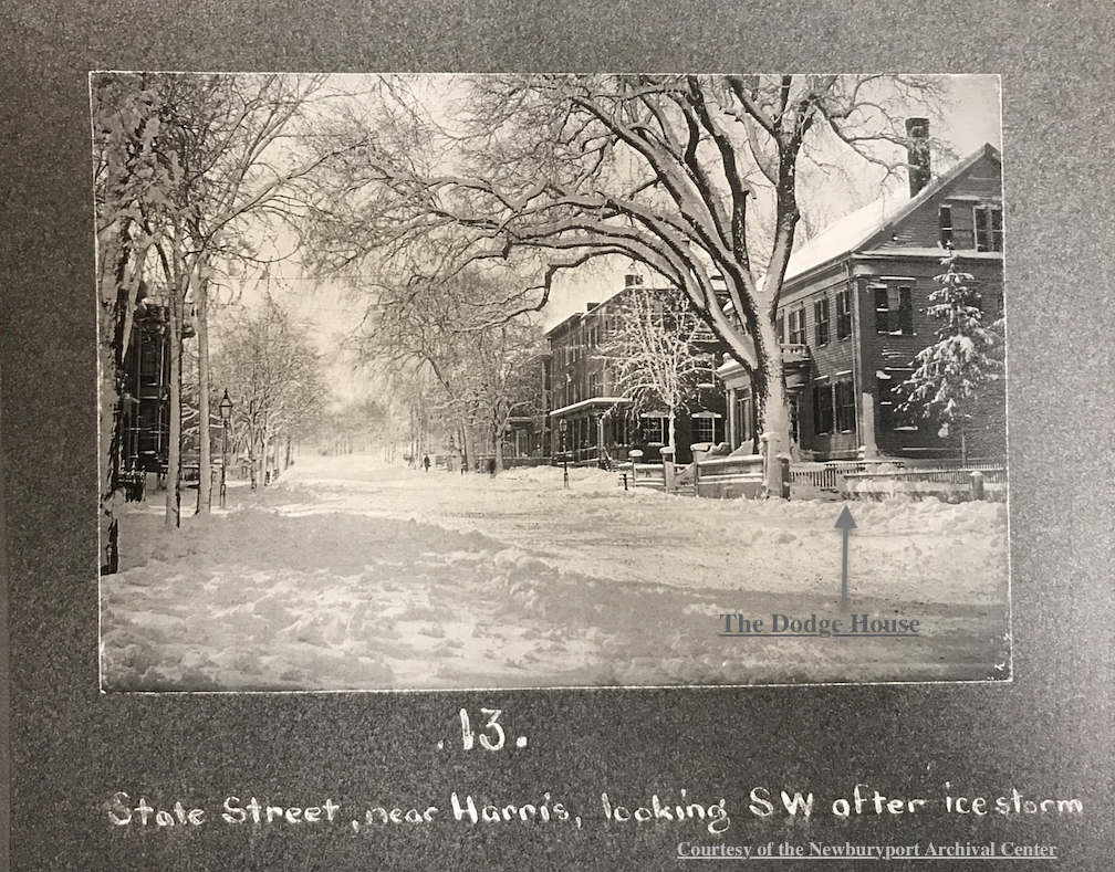
“ The country road, now High Street, was then a narrow path or way leading to the ferry at Carr’s island. Under the direction of the way wardens, or surveyors of highways, it was laid out, four rods wide, for a distance of six miles from the north bank of the Parker river (“High Street, beginning at the Parker River and extending to Three Roads so called.” **^^) (Currier is referring in this paragraph to the year 1649). Recently the road-bed had been greatly improved by reducing the grade in some places, and laying a firm and solid foundation of broken rock, covered with a finer coating of the same material, nearly the whole length of the road. When the work is completed, this ancient thoroughfare will be under the care and control of the Board of Highway Commissioners appointed by the state.” **
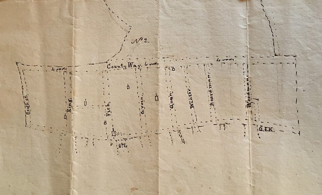
Boardman Street was laid out as a “way” in 1754 and was called Boardman lane, and then was called Boardman Street in 1764 (when the city separated from Newbury and was incorporated.) ***
Olive Street was laid out as a “way” as early as 1755, in 1794 it was called called Olive lane, and 1817 the town of Newburyport voted to accept Olive Street as a public road. ****
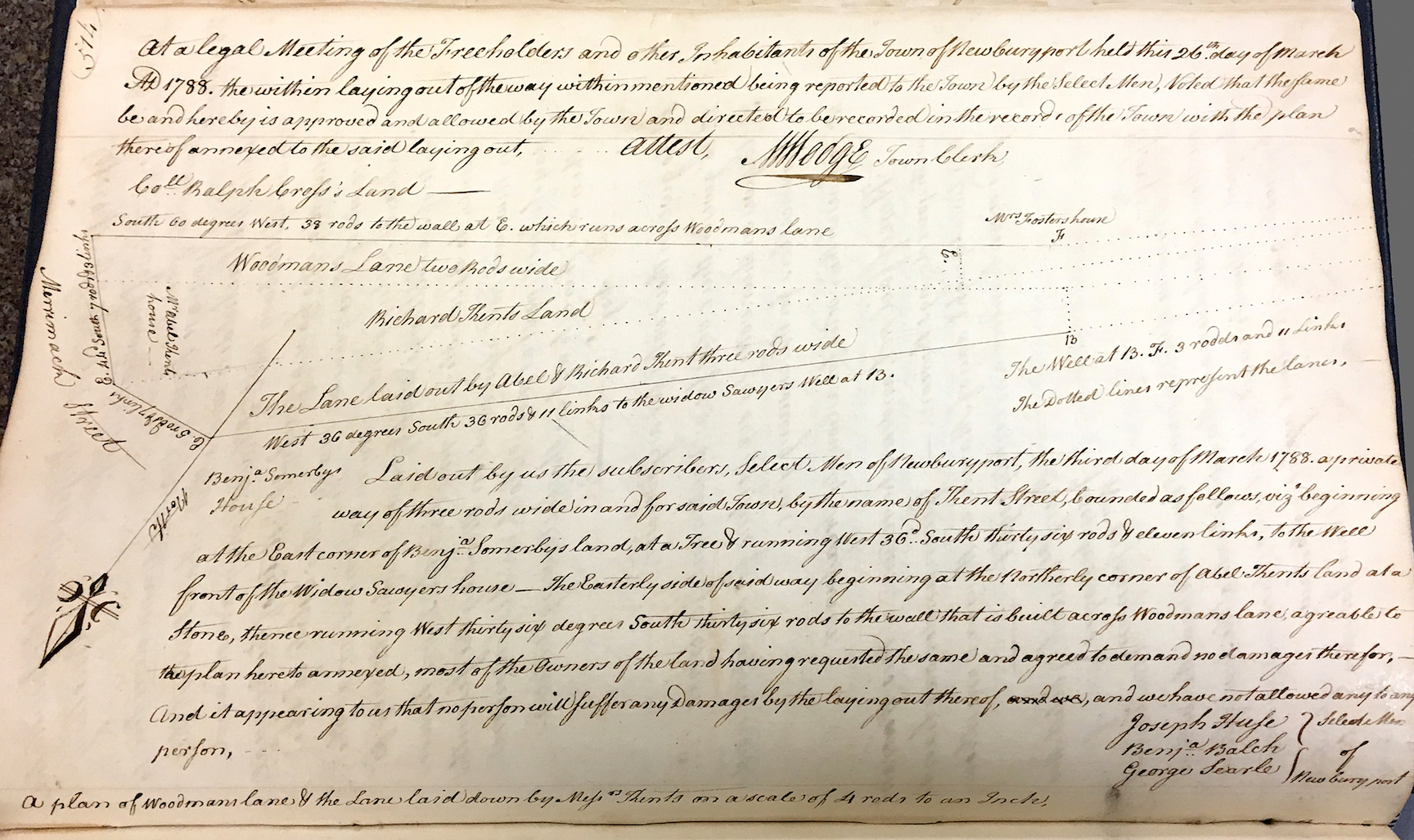
Kent Street has a very interesting story and may be part of the reason why High Street is so wide in that particular area.
“The brook ceased to flow before Old Newbury was settled. It drained the land between Kent and Olive Streets from the river to High Street, as well as the high land to the summit of the Ridge. It carried a great a great deal of water and many tons of silt to the landing at which it found its way to the Merrimac and tore out the earth a gully that reaches from Russia Street to Merrimac.” *^
It was the creation of Kent Street in 1788 that lead to the building along High Street in the North End, the previous lane/road had been described in the North End Papers as being very dangerous.
Drawing of Kent Street from the Newburyport Records 1764-1789, year 1788, Courtesy of the Newburyport Archival Center
Drawing of Kent Street from the Newburyport Records 1764-1789, year 1788, Courtesy of the Newburyport Archival Center
“The pleasant locations upon the higher land away from the river were not desired or could not be obtained. The opening of Kent and the new streets above started an interest in real estate that lasted until the time of the war of 1812.
“In 1800 Olive lane and Kent Street ran from Merrimac to High. (Ash Lane and Merrill lane, the present Russia Street) No other lanes were open in the whole tract of land from Merrimac to High and from Olive to Kent streets.” **^
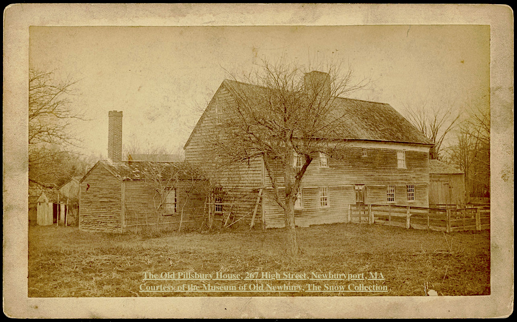
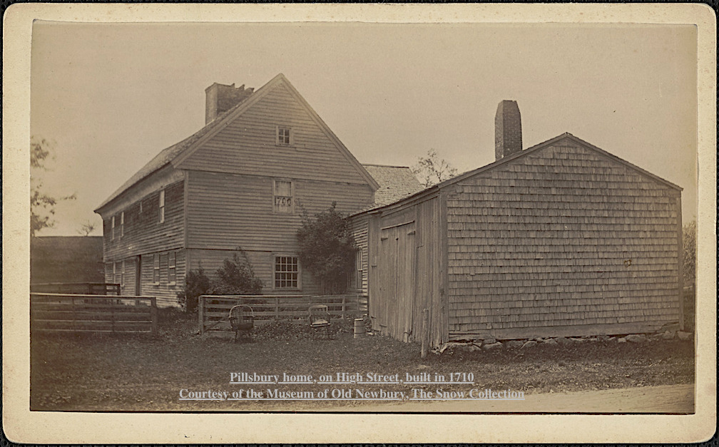
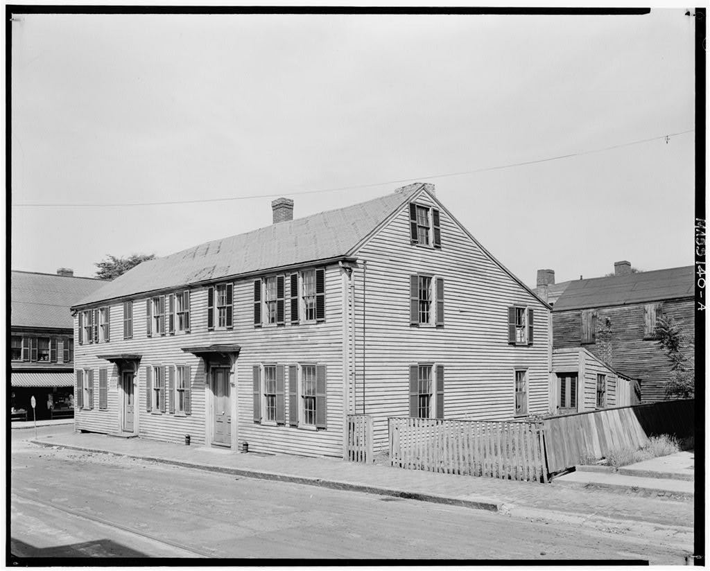
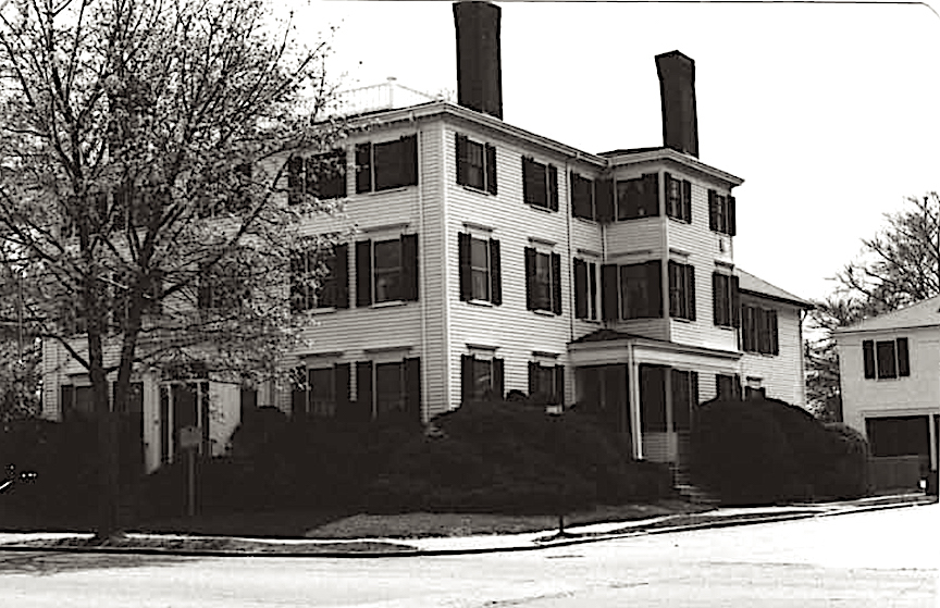
203 High Street, was built in 1774, it was owned by John Lowell, and is known as the Lowell-Tracy-Johnson House.
201 High, the Jackson-Dexter House (Lord Timothy Dexter) was built in 1771 and is near what is now Dexter Lane.
At that time 201 and 203 High were probably on the edge of Newburyport, the rest of High Street being trees, farms and the occasional slaughtering house for farm animals. 203 High Street is just at the edge of where the roadway widens.
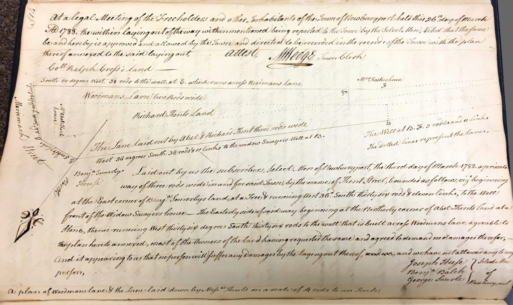
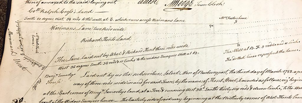
The town records discuss what is then Woodman lane (a version of what is now Kent Street) in 1765, the comments appear to be pretty critical of the effort by the town of Newbury to create Woodman lane – “it is of no use to the town,” “but as it is now esteemed to be none (no service to the town).” ***^
In 1765 the selectmen recommend a new road, however, Kent Street did not get built until 1787-1788, twenty years later (things took time to get accomplished back then as well apparently.) ***^
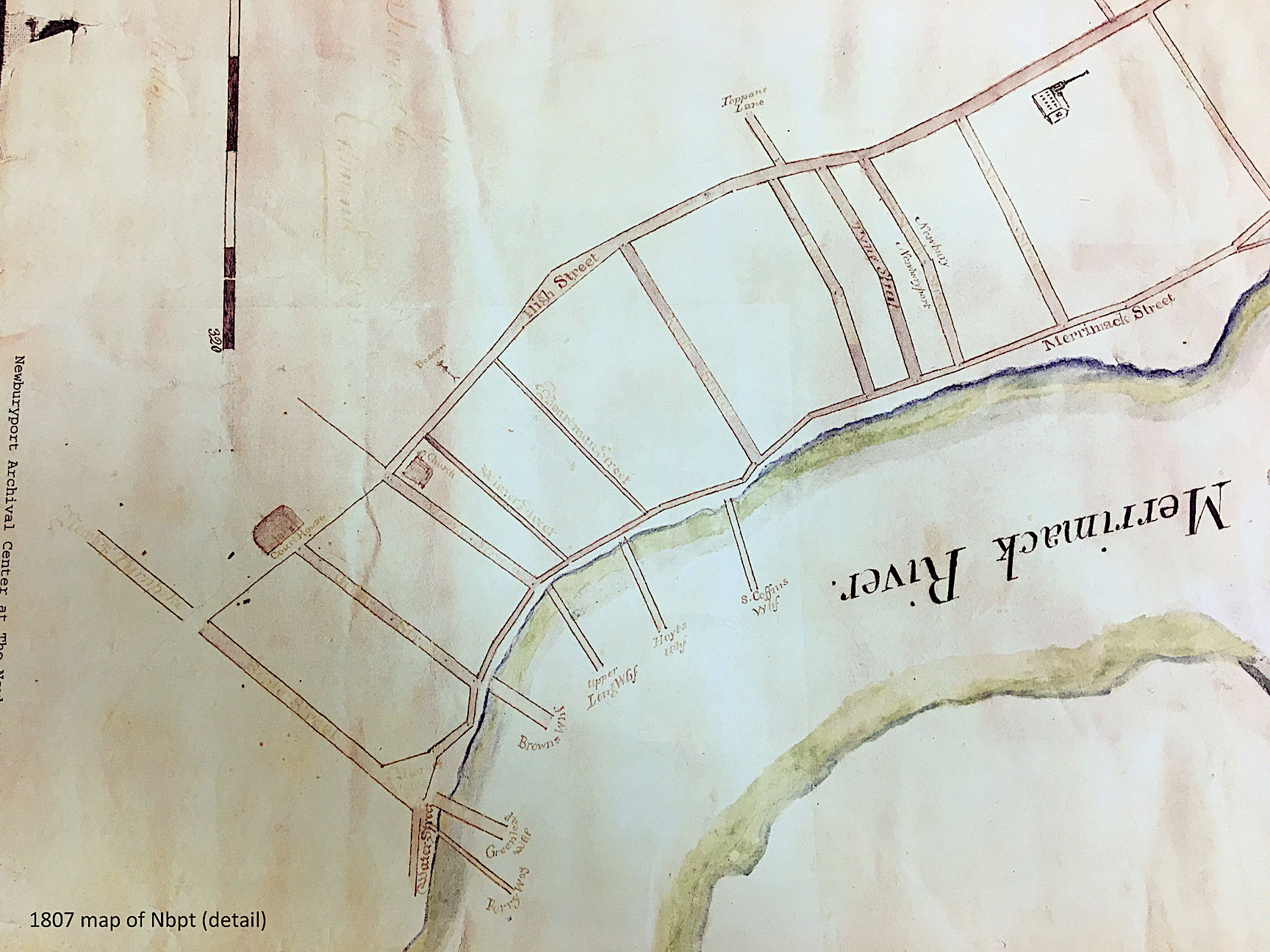
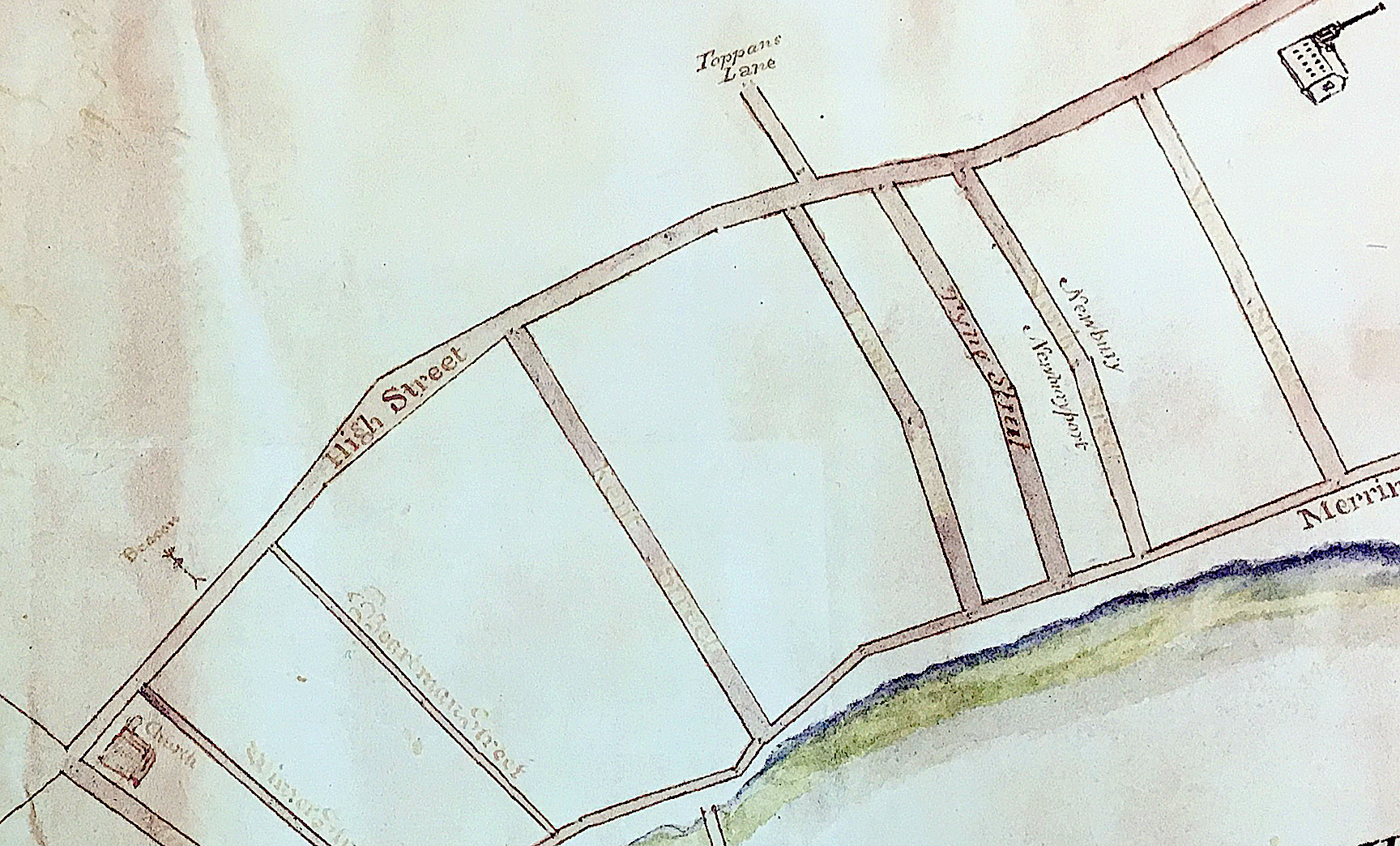
Sharon Spieldenner found a map from 1807 that shows the widening around Buck and Kent Street.

Detail of a 1807 map that shows the wide part of High Street, Courtesy of the Newburyport Archival Center
Detail of a 1807 map that shows the wide part of High Street, Courtesy of the Newburyport Archival Center
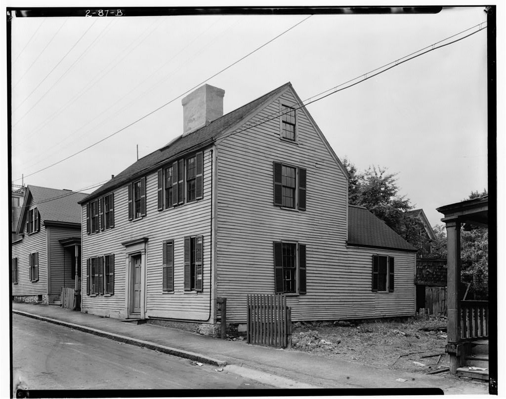
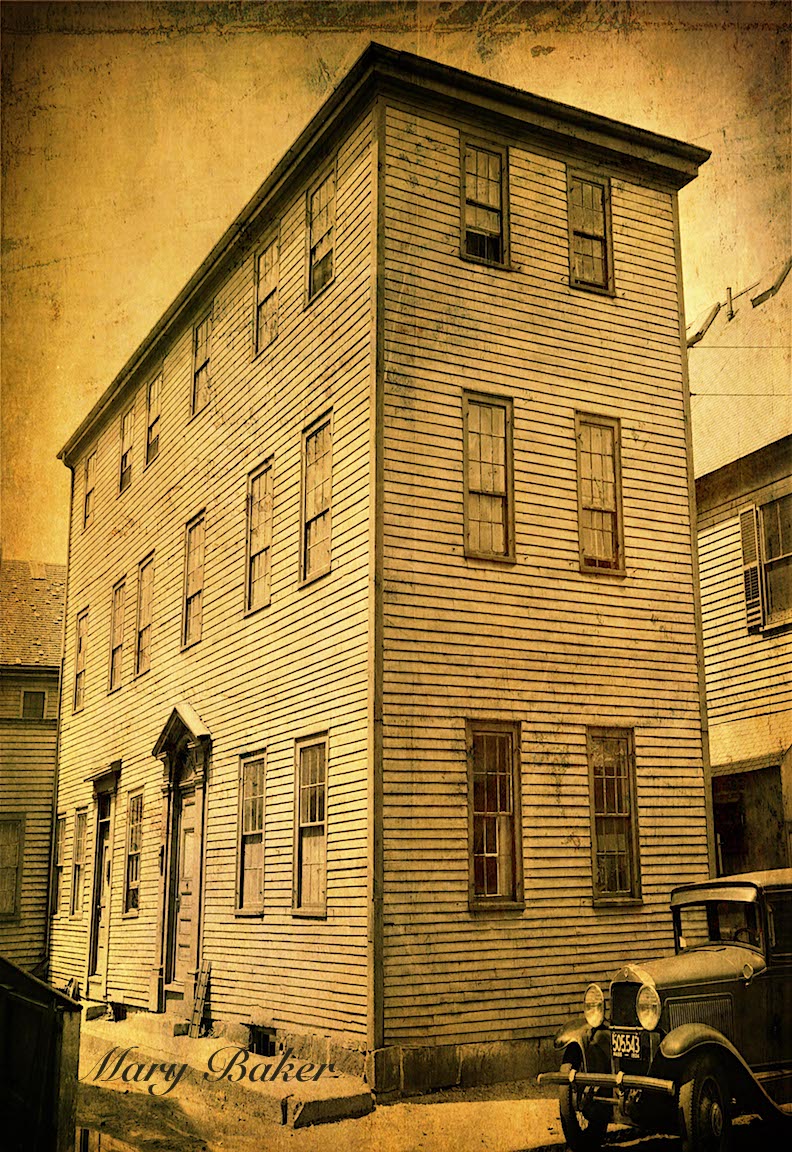
218 High Street, now on the corner of Buck and High was built in 1797 by Captain John Buck. Buck Street was created in 1800, it sits right at the edge of the existing street right where the roadway begins to widen.
218 High Street, Newburyport MA
218 High Street, Newburyport MA
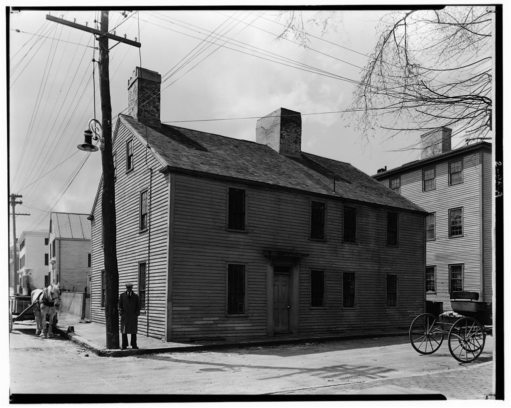
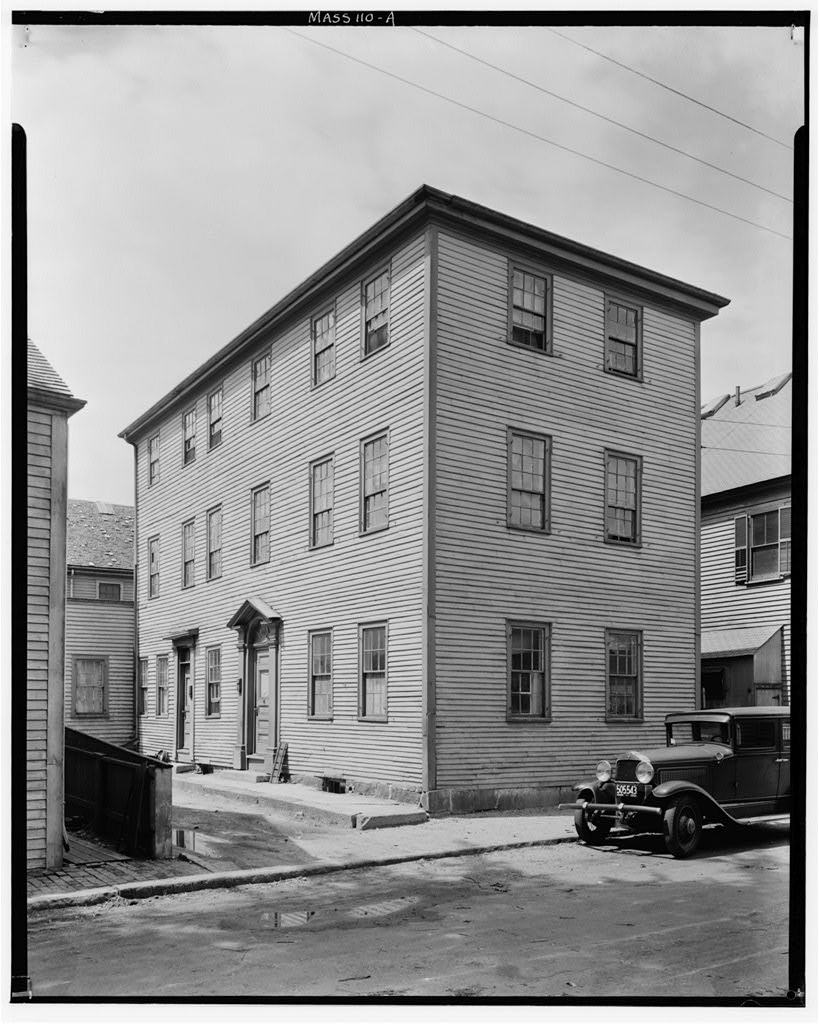
209 High Street, now on the corner of Johnson and High, was built in 1806 also sits on the edge of where the roadway is now. So it appears that we have at least circumstantial evidence that High Street was wide in that area as early as 1797 – 1806, over 2 centuries ago.
209 High Street, Newburyport MA
209 High Street, Newburyport MA
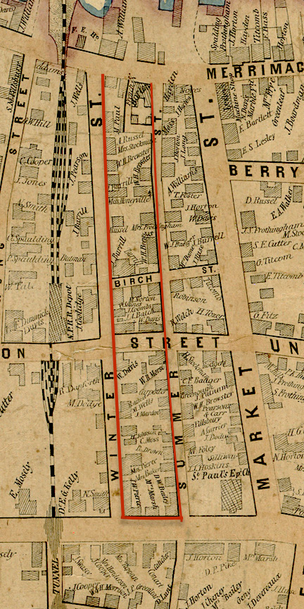
The wide part of High Street and 213 and 223 High Street from today’s city map.
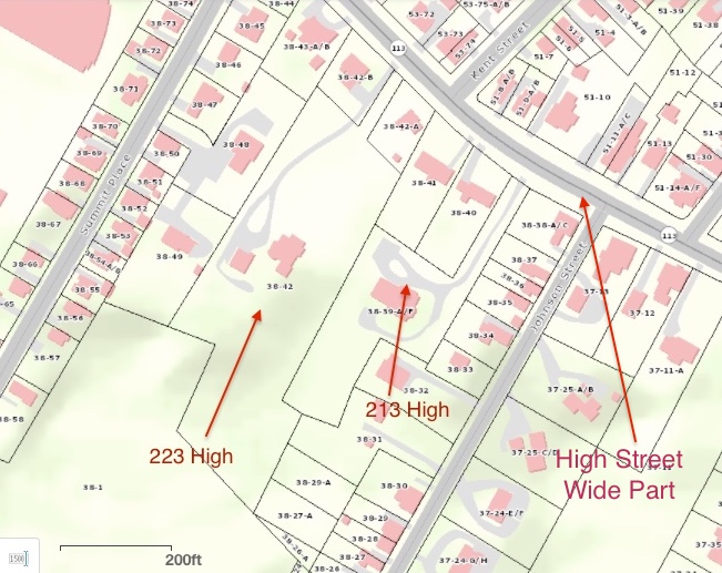
The wide part of High Street and 213 and 223 High Street from today’s city map.
1924 Assessors Map
1924 Assessors Map showing the wide part of the road and 213 and 223 High Street
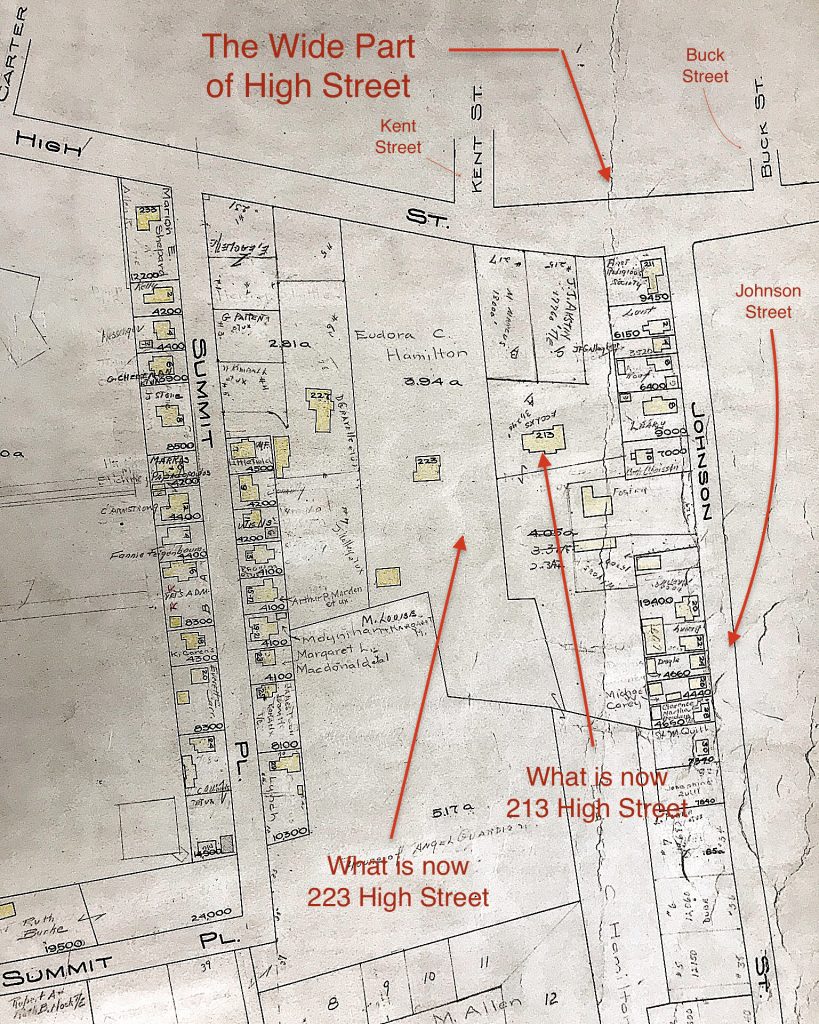
1924 Assessors Map showing the wide part of the road and 213 and 223 High Street
Survey from 1961 of 213 High Street, showing the wide part of the road.
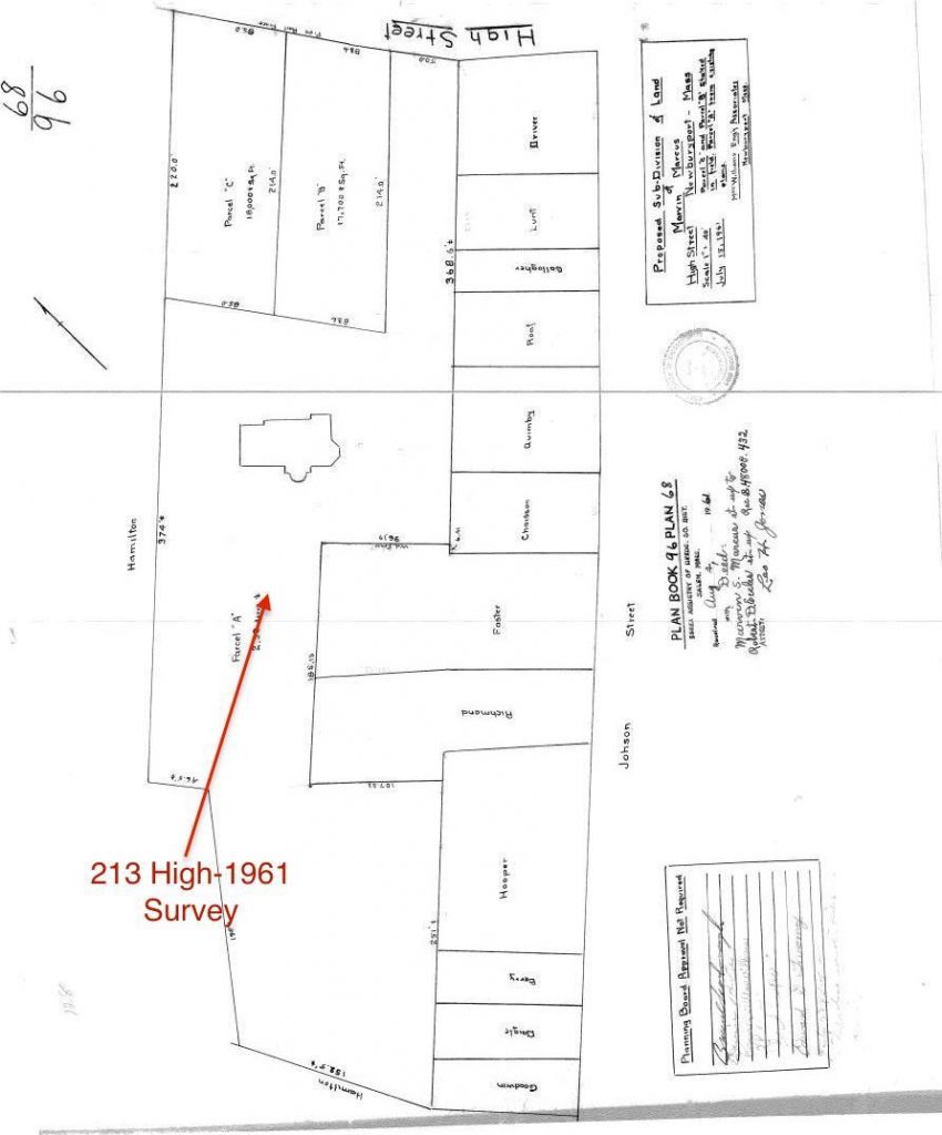
Survey from 1961 of 213 High Street, showing the wide part of the road.
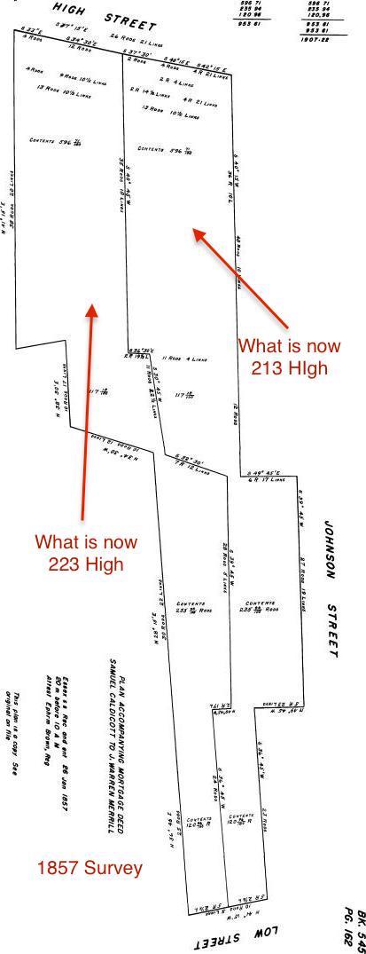
In 1857 there is a survey of what is now 213 and 223 High Street. The land fits perfectly into the land lots (that have now been partially broken up) that exist in today’s city’s map. It shows the angle of the roadway exactly as it is today. So we have absolute proof that High Street was wide in that area for 150 years. (Carrie Keville from the Newburyport Assessor’s Office helped me find the survey.)
Survey from 1857 of what is now 213 and 223 High Street that proves that the roadway was as wide as it is today.

Survey from 1857 of what is now 213 and 223 High Street that proves that the roadway was as wide as it is today.
This is a topographical map from the city that I’ve “tweaked” and shows how the “brook” could have gone down the bottom of 213 High and/or Johnson Street, down what is now Kent Street causing the “gully” as well as possibly down what is now Buck and Olive Streets. It is a theory as to why that part of the roadway may be extra wide in that particular spot.
Topographical map showing the area around Bunk, Johnson and Kent Streets
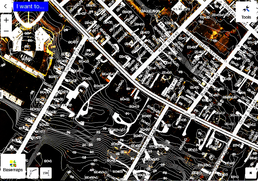
Topographical map showing the area around Buck, Johnson and Kent Streets
It appears that High Street has been wide at Buck, Johnson and Kent Streets for at least 150 years, and it also appears that the street could have been that wide in that particular area for two centuries.
*An Informal History of the Downtown Streets of Newburyport 1972, Section on High Street by Josephine P. Driver, Page 131.
(“Josephine P. Driver (1893-1983), one-time curator of the Historical Society of Old Newbury, reminiscences about her childhood memories of her uncle, Elisha P. Dodge, a well-known Newburyport mayor and businessmen, published in Captains, Clams, and Cobblestones, 1977. Her father, Henry B. Little, was a long-time president of the Institution for Savings bank. Mrs. Driver was one of the many citizens and driving forces who advocated for the historic restoration of Newburyport’s downtown during the 1960s.” – Clipper Heritage Trail – Ghee Woodworth)
** John J. Currier, The History of Newbury, Mass.,1635 – 1902, Pages 414 -415
*** John J. Currier, History of Newbury, Mass., 1635 – 1902, Page 342
**** John J. Currier, History of Newbury, Mass., 1635 – 1902, Page 342
*^ North End Paper 1618 – 1880, Newburyport, Massachusetts: Development of the North End of the City, by Olive Bl Merrill, Transcribed by Margaret Pecham Motes, Pages 81 and 82.
**^ North End Paper 1618 – 1880, Newburyport, Massachusetts: Development of the North End of the City, by Olive Bl Merrill, Transcribed by Margaret Pecham Motes, Page 110.
***^ Newburyport Records 1764-1789, year 1765, Vol 1, page 38
**^^ John J. Currier, The History of Newbury, Mass.,1635 – 1902, Footnote, Page 90
*^* The Safe Streets to School project is the incentive for the narrowing of this particular area of High Street. As I understand it the goal is that the “overall safety benefits should be considered in balance with historical objectives.”
Editor’s Note – Kent Street:
Woodman’s Lane, now Kent Street, was probably laid out as early as 1675. In the Newburyport Records 1764-1789 Vol 1, page 38, there is a mention of “an agreement between Colonel Kent, Mr Woodman and the selectman,” the dates that are given for this agreement are 1722/23. It appears that over the years the town was struggling with this part of what is now lower Kent Street, and that the opinion in 1765 is that the road that was created around 1723 was “of no use to the town.“ *^^*
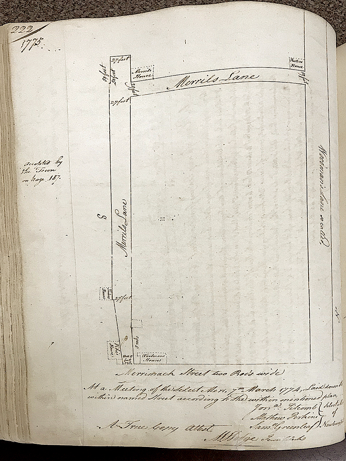
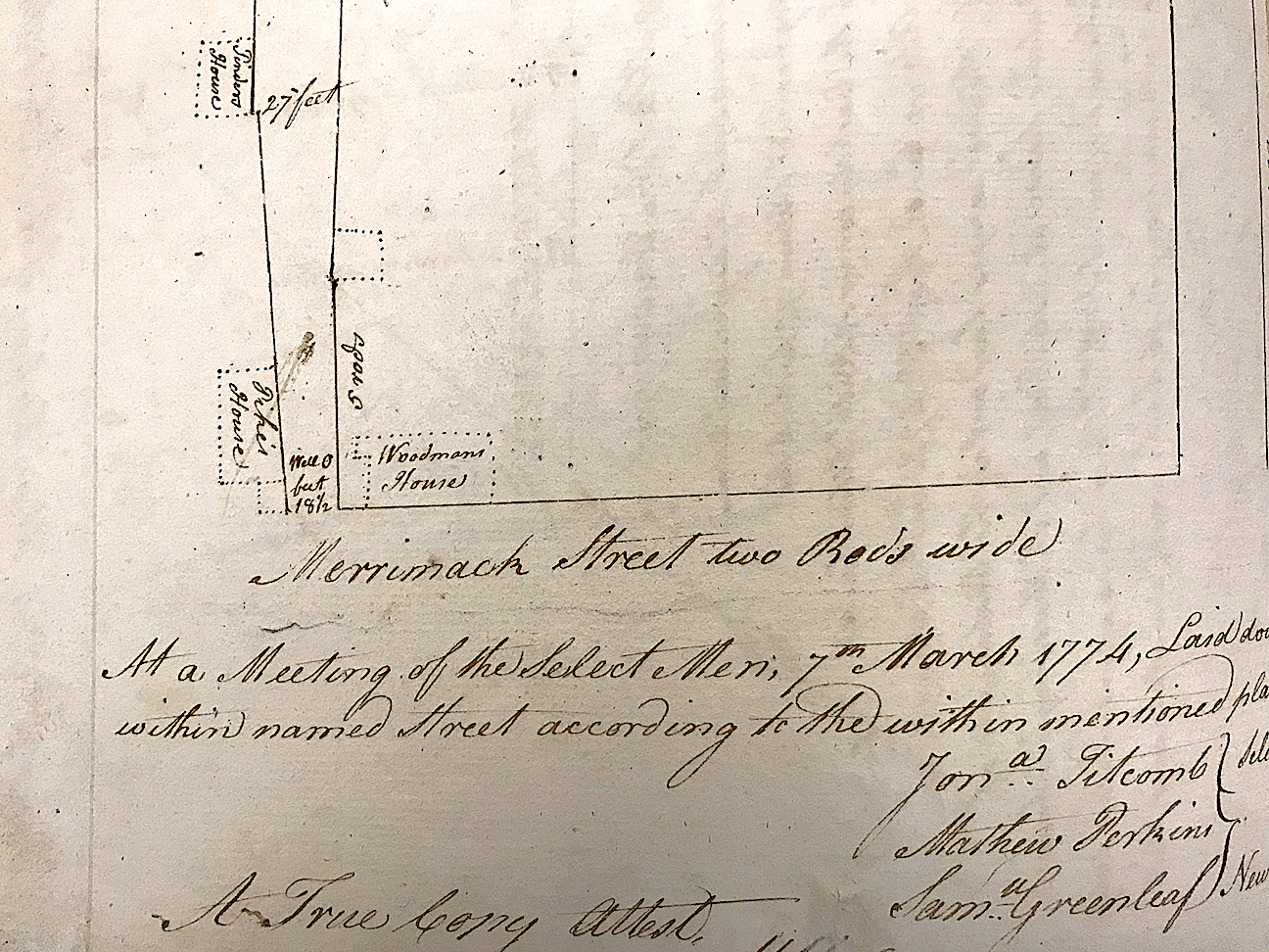
The two drawings below are what lower Kent Street – then a combination of Woodman’s Lane and Merrill Lane, which was trying to negotiate around the gully, once looked like.
Here are two images from the Newburyport Records 1764-1789, Vol 1, page 222, courtesy of the Newburyport Archival Center
Map of Wood’s Lane and Merrill Lane 1775 from the Newburyport Records 1764-1789, Vol 1, page 222, courtesy of the Newburyport Archival Center

Map of Wood’s Lane and Merrill Lane 1775 from the Newburyport Records 1764-1789, year 1775, Vol 1
Detail of the map of Wood’s Lane and Merrill Lane, from the Newburyport Records 1764-1789, year 1775, Vol 1, page 222, courtesy of the Newburyport Archival Center
Detail of the map of Wood’s Lane and Merrill Lane 1775 from the Newburyport Records 1764-1789, year 1775, Vol 1.
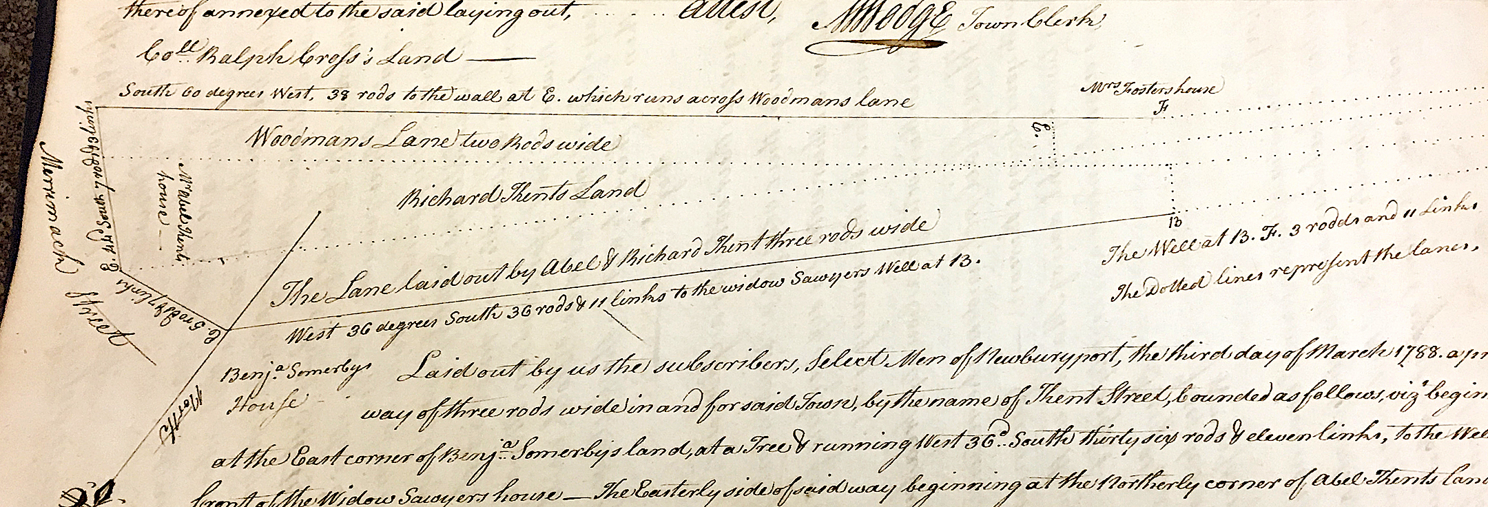
And from the survey of Kent Street in 1788 it looks like lower Kent Street was completely re-configured, moving the entire lower part of the roadway north of the existing street.
Detail of the survey of Kent Street in 1788, it looks like lower Kent Street was completely re-configured, moving the entire lower part of the roadway north of the existing street. *^*^
Detail of the survey of Kent Street in 1788, it looks like lower Kent Street was completely re-configured, moving the entire lower part of the roadway north of the existing street.
*^^* John J. Currier, History of Newbury, Mass., 1635 – 1902, Page 344
*^*^ Detail of the drawing of Kent Street from the Newburyport Records 1764-1789, year 1788, courtesy of the Newburyport Archival Center.
Editor’s Note:
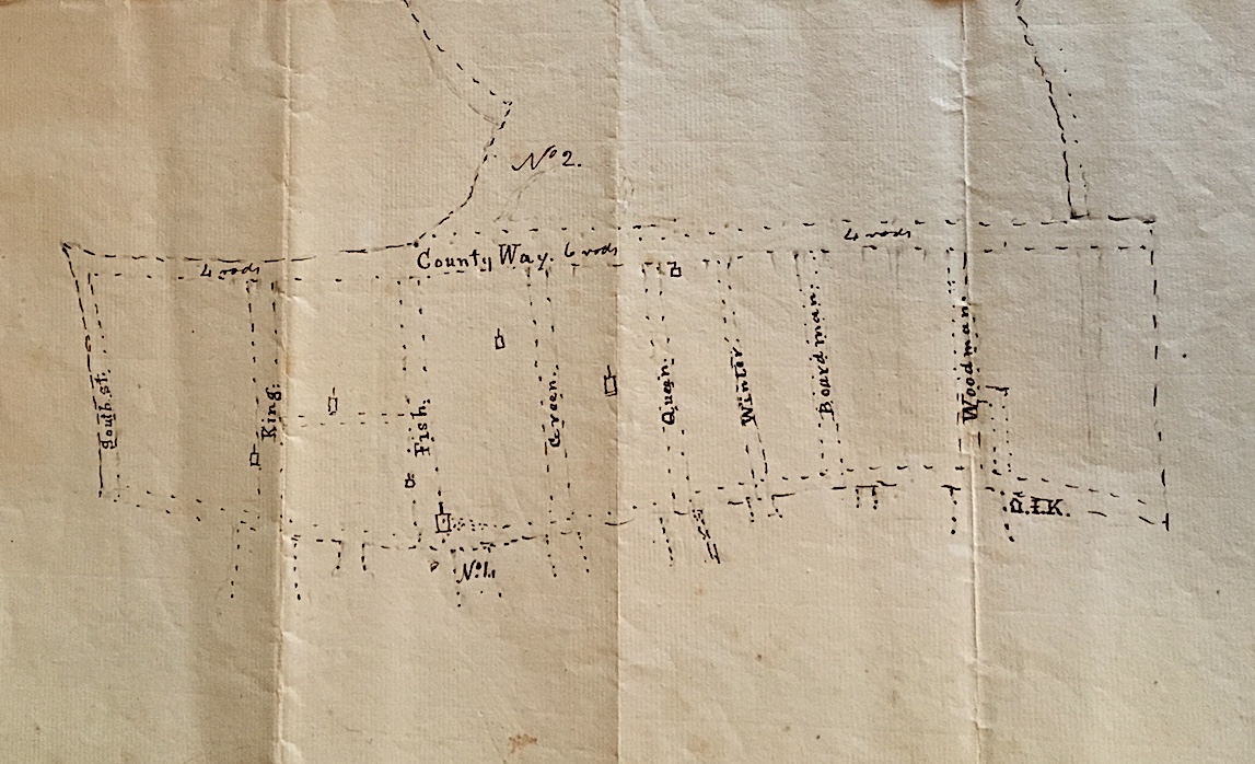
This is a detail of really early map courtesy of Sharon Spieldenner of the Newburyport Archival Center. A guess on the date might be around 1720.
A detail of a really early map courtesy of Sharon Spieldenner of the Newburyport Archival Center. A guess on the date might be around 1720.
A detail of a really early map courtesy of Sharon Spieldenner of the Newburyport Archival Center. A guess on the date might be around 1720.
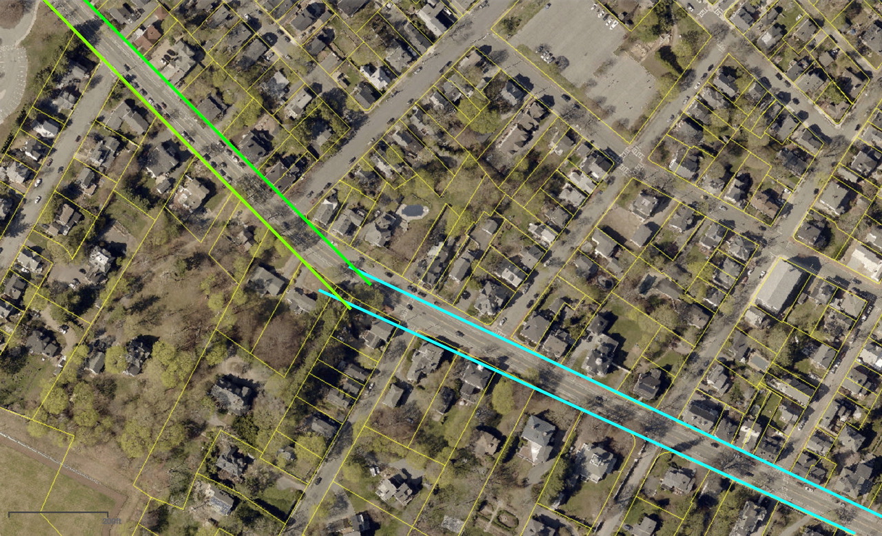
This is a theory/guess by Rick Taintor as to why the High Street is so wide between Kent and Buck Street.
“The road was laid out at a specific width, but probably wasn’t engineered with curving sidelines. I’ve drawn two pairs of straight lines representing a theoretical original layout, meeting at an angle just west of Johnson Street.
However, the early users probably cut corners, especially when pulling wagons rather than just riding horses, and particularly where no development had yet occurred. Over time, the actual roadbed could have shifted to a smooth curve between Kent and Johnson, so the traveled way might have moved out of the original sidelines. At some later date, the angle of the sideline on the north side of the road could have been adjusted to ensure that the right of way encompassed the traveled way.”
A drawing of a theory of why the High Street is so wide between Kent and Buck Street.
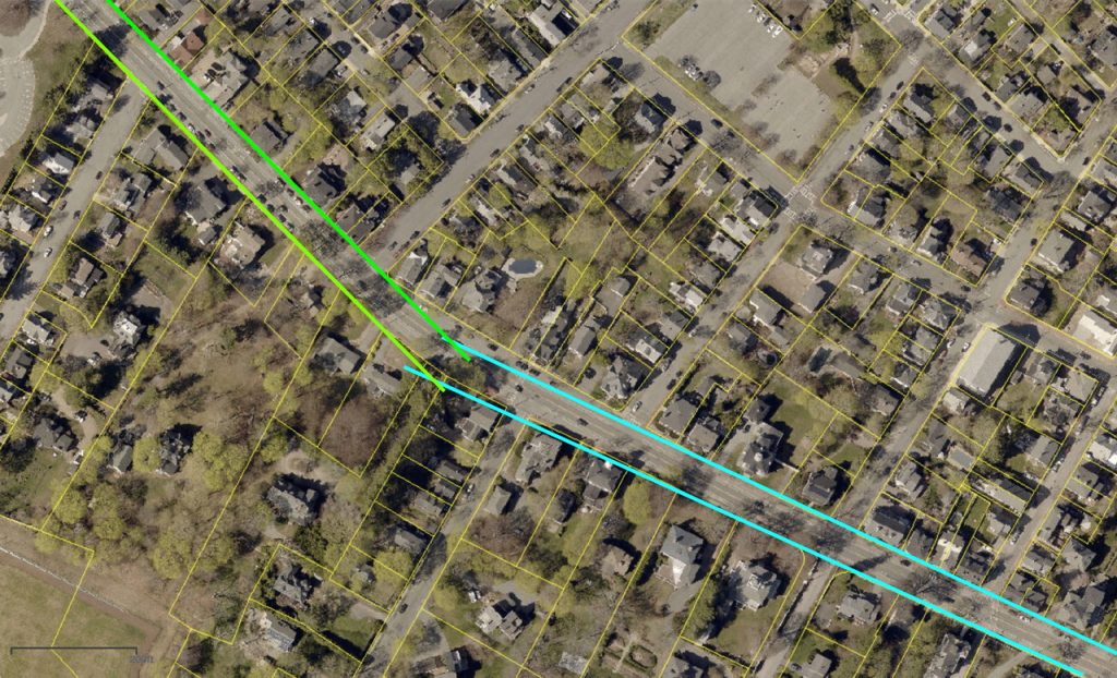
A drawing of a theory of why the High Street is so wide between Kent and Buck Street.
From John J. Currier “History of Newburyport, Mass: 1764 – 1905” Vol I, page 22, the map was drawn in 1795 but represented Newburyport in 1764. High Street bends at Woodman’s lane. Reproduced from the Massachusetts Archives (Town Plans, vol II., Part I.)
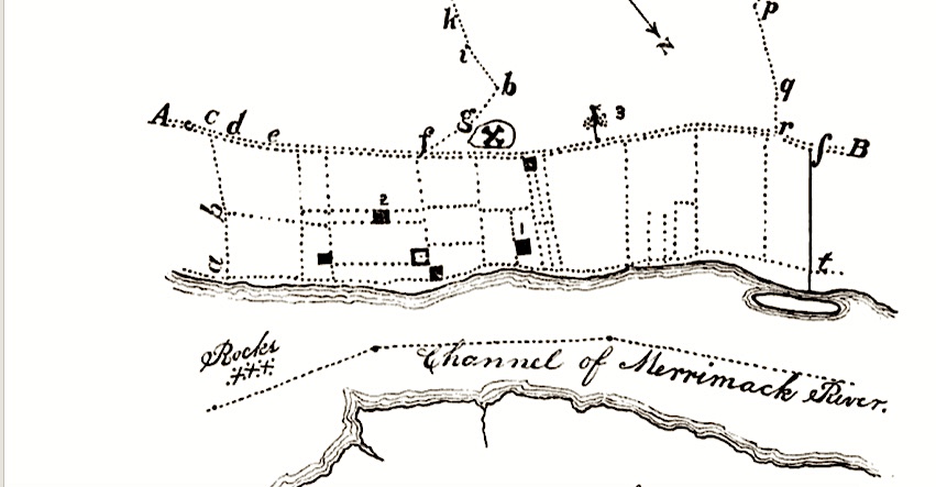
From John J. Currier “History of Newburyport” Vol I page 22, the map was drawn in 1795 but represented Newburyport in 1764. High Street bends at Woodman’s lane.